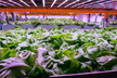
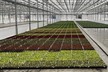
Greenhouse cultivation has been expanding rapidly in recent years, yet little knowledge exists on its global extent and expansion. Using commercial and freely available satellite data combined with artificial intelligence techniques, we present a global assessment of greenhouse cultivation coverage and map 1.3 million hectares of greenhouse infrastructures in 2019, a much larger extent than previously estimated. The analysis includes both large (61%) and small-scale (39%) greenhouse infrastructures. Examining the temporal development of the 65 largest clusters (>1,500 ha), we show a recent upsurge in greenhouse cultivation in the Global South since the 2000s, including a dramatic increase in China, accounting for 60% of the global coverage. Researchers emphasize the potential of greenhouse infrastructures to enhance food security but raise awareness of the uncertain environmental and social implications that may arise from this expansion. They further highlight the gap in spatio-temporal datasets for supporting future research agendas on this critical topic.
Tong, X., Zhang, X., Fensholt, R. et al. Global area boom for greenhouse cultivation revealed by satellite mapping. Nat Food (2024). https://doi.org/10.1038/s43016-024-00985-0