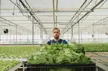
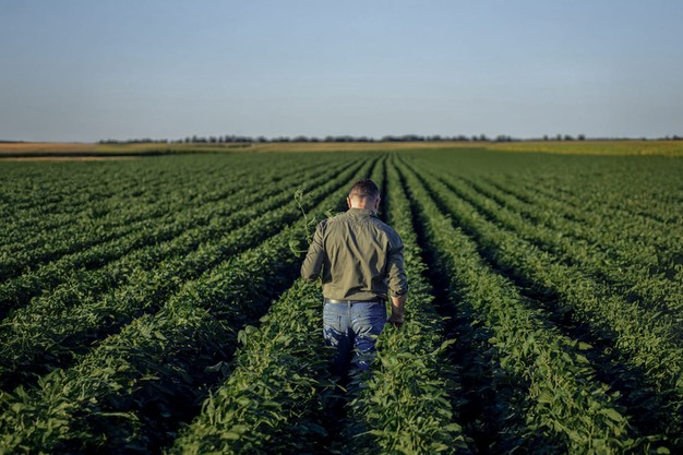
WayBeyond has launched GrowPilot, a mobile application designed to help small to medium-sized commercial growers respond to climate-driven crop risks. The app combines satellite-derived data with artificial intelligence (AI) models to provide localized forecasts and predictive alerts for conditions that may affect crop health, including temperature spikes, heavy rainfall, strong winds, and plant stress indicators. "We wanted to create a tool for growers who manage daily crop decisions without the support of dedicated agronomy teams," says CEO Darryn Keiller, adding that this is the industry's first AI agronomy app specifically for this segment of growers.
 © Autogrow / waybeyond
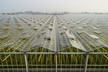
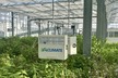
WayBeyond's existing platform, FarmRoad, focuses on gathering data from local sensors and providing insights for larger, tech-enabled operations. However, Darryn explains that such solutions can be too costly or complex for the average grower. "We wanted to make our technology interpretation more scalable and accessible to the broad market. With GrowPilot, it's essentially any farmer, any grower, anywhere." This sensorless design allows the platform to be scaled across regions where installing hardware is cost-prohibitive or logistically challenging, including parts of Africa and Asia.
GrowPilot builds on the GrowPilot messaging service introduced in 2024, which delivered daily weather and irrigation forecasts via WhatsApp to growers in more than 28 countries. The new app introduces a free tier with basic weather and ETo information, while the Plus tier adds risk alerts and extended forecasts, available after a 14-day trial for a monthly fee.
The app integrates weather and climate data sourced from low-Earth-orbit satellites and third-party providers, including the global aggregator Spire. "This approach bypasses the need for on-farm sensors, relying instead on remote sensing data and local weather station information to generate forecasts tailored to individual farm locations," Keiller explains. Growers register their farm address in the app, which is converted to GPS coordinates for site-specific predictions.
 © Autogrow / waybeyond
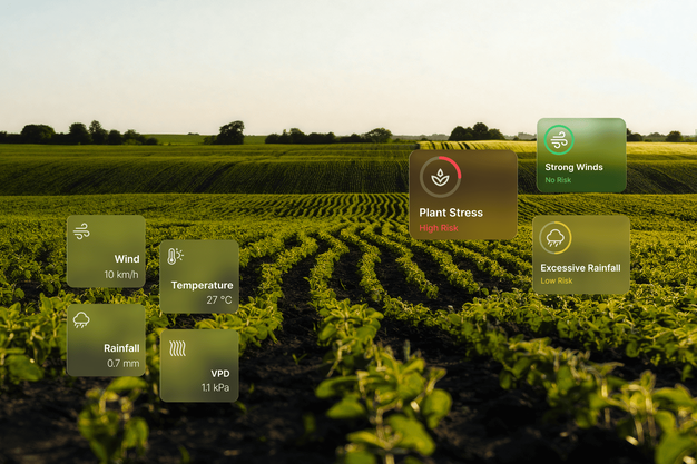
GrowPilot offers multiple layers of agronomic insights. Hourly localized forecasts cover temperature, rainfall, wind, and Vapor Pressure Deficit (VPD) for up to 48 hours, along with a seven-day outlook for planning irrigation, crop management, and other operational activities. Evapotranspiration (ETo) forecasts are integrated with crop water-demand models to guide irrigation decisions.
According to Mpatisi Moyo, Head of Artificial Intelligence at WayBeyond, the app is intended to close the gap between data and actionable decisions. "We want to provide growers with guidance on what to do when conditions change, rather than just giving them raw data," he explains, noting that many growers—especially those without desktop access or agronomy support—lack time or expertise to interpret complex datasets. "GrowPilot is designed to deliver insights in a format accessible via mobile devices, emphasizing immediate applicability on the farm."
GrowPilot's alerting system notifies growers of weather and crop-risk events before they materialize, including plant-centric thresholds such as temperature or VPD levels linked to stress responses. The app focuses on the grower as the primary decision-maker, with data security and accessibility as core design considerations. Because GrowPilot relies exclusively on third-party datasets, users only access information relevant to their registered location, and no raw on-farm environmental data is required.
Mpatisi emphasizes that the objective is to democratize actionable insights. By transforming satellite and environmental datasets into practical recommendations, the app enables growers to plan operations, irrigation, and crop protection measures without specialist analysis. "Growers don't necessarily know what to do with data," she says. "Our goal is to link observations directly to operational actions."
 © Autogrow / waybeyond
He adds that GrowPilot aligns with a broader industry shift toward remote sensing and AI-driven insights. "Low-Earth-orbit satellites have increased access to environmental data, while domain-specific AI models can interpret this information at a biological level. For example, evapotranspiration and VPD data can be linked to known plant stress responses, enabling alerts tailored to specific crops or microclimates."
While initial deployment focuses on climate, weather, and irrigation insights, WayBeyond plans to expand GrowPilot's capabilities over time. Agronomists are involved in the development process to ensure alerts align with practical field requirements. The goal, according to Mpatisi, is to provide growers with low-effort, actionable guidance in real-time, without requiring on-site sensor networks or complex platforms.
GrowPilot is now available for download on iOS and Android devices.
For more information:
WayBeyond
www.waybeyond.io