US (TX): New web app expedites NRCS response to Harvey
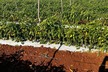
NRCS staff routinely visits affected areas following damaging and even catastrophic weather events. They complete Damage Survey Reports (DSRs), documenting the type and amount of destruction that has occurred on the farm to resources such as crops, soils, livestock, and fences. Reports include the location of damage, with photos.
Justin Parks, NRCS District Conservationist in Lufkin, Texas, uses the agency’s Harvey Damage Reporter app to mark the location of Village Creek, between Jasper and Beaumont, Texas, to document damages caused by Harvey’s floodwaters.
Texas NRCS State Conservationist Salvador Salinas says the app is a win-win for the agency and producers affected by the hurricane. What once took hours to document can now be done in minutes. Photos taken with a smartphone are geo-tagged, and pinpointed on the map so any staff member can log in and see the pictures to know exactly where they were taken. Salinas says the app has the potential to reduce staff time spent documenting DSRs by as much as 80 percent, which frees up more time for one-on-one producer assistance. A quicker assessment may ultimately help victims recover their livelihood sooner following a storm.
NRCS State Soil Scientist Alan Stahnke, GIS Technician Steven Diehl, and other staff members worked for several months on an ArcGIS application, ArcCollector, to develop the app. With Hurricane Harvey on the radar, the team worked hard and fast to ready the app. The resulting tool can record damage and collect information on all the points into a central database.
NRCS State Resource Conservationist Kristy Oates was one of first specialists to use the app in the field. She says the new web-based tool is extremely user-friendly and accurate. “As soon as roads were passable, I traveled through some of the hardest hit areas in Refugio, Port Lavaca and Victoria and was able to document cropland damages, livestock concerns, debris and erosion issues,” said Oates. “This will be very helpful in determining how to allocate staff resources and other assistance needed in different areas.”
The app contains other features such as road closure and frequent satellite map updates as they are made available through the Environmental Systems Research Institute (ESRI).